
Key insights
-
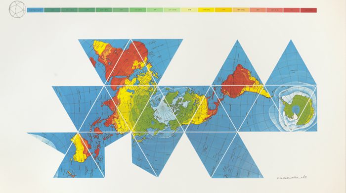
1
Minimizing Distortion
Fuller's Dymaxion Map aims to reduce the distortion of landmasses and the oceans by presenting the Earth on a two-dimensional surface in an innovative way. Unlike traditional maps, it avoids the issue of representing the curved surface of the globe on a flat plane.
-
2
Innovative Design
The map is composed of a series of triangular sections that can be folded into a three-dimensional icosahedron, allowing for a more accurate depiction of the continents' relative sizes and distances.
-
3
Lasting Influence
Fuller's approach to mapmaking continues to influence contemporary cartographers and has inspired a range of educational and design projects aimed at providing a more accurate representation of the world.
Takeaways
Buckminster Fuller's Dymaxion Map, introduced in 1943, revolutionized the field of cartography by offering a new way to represent the Earth's surface with minimal distortion. Its innovative design continues to inspire and inform modern mapmaking.